Cities may be quieter than usual right now, but there will always be people on the move. Whenever they want to go somewhere, they want to do it fast, conveniently and safely — especially these days.
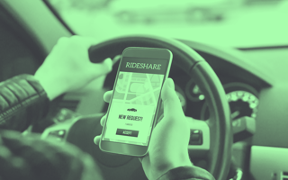
Rideshare services have equipped the interiors of their vehicles accordingly with acrylic partitions, sanitizers and masks — but have they adjusted their behavior on the road? Data is key to do so, and rideshare assistant apps have it.
When customers need a ride, they don’t want to scroll through every rideshare app on the market to find their perfect match. And drivers don’t want to spend most of their time cruising neighborhoods on the lookout for potential clients.
To make urban mobility as efficient as possible and bring driver and client together, data is key. Drivers need to know where people are waiting, what safety hazards and traffic jams are crossing their way and which areas in town are overserved by a variety of rideshare services and therefore should be avoided.
The long-term strategy is to make urban mobility sustainable and city-compatible by leaning on digital solutions. Over the past few years, more and more startups have made it their mission to be of assistance for employees of the mobility sector working for companies such as Uber, Lyft Free Now, Bolt and Ola.
Here are three examples:
- Cities like Hamburg push their mobility transition strategy by combining a strong public transport system and networked mobility offers. The city recently launched an app called HVV Switch, which bundles with public transport and sharing offers for the public.
- QAAR Driver is another example — this time based in New York — and that lets customers pay in cryptocurrency in addition to all modern paying options.
- Finally, German startup Bliq Ride aims to provide relevant insight into passenger hotspots, competitor mobility and safety hazards on the road. Founded in 2018 and originally developed to spot empty parking spots in overcrowded cities, the Bliq app targets rideshare and delivery drivers by combining all ridesharing apps (Free Now, Uber and more) into one. Drivers can receive all their ride or delivery offers in one place and are able to filter rides according to their preferred criteria.
The Power of Real-Time Analysis
So how can we capture these insights and use them to take urban mobility to the next level?
One idea is to use GPS to track a vehicle or determine whether a traffic jam awaits around the corner — thus increasing efficiency for both rider and driver. However, there is a way beyond GPS to understand the world around the car: computer vision. This branch of AI uses real-time image analysis and videos as well as deep learning models to correctly identify, locate and classify objects.
The technology is indispensable in autonomous vehicles — which rely on cameras, radar and lasers to understand the world around them. Bliq is among the first services to integrate computer vision with selected vehicles to collect and supply relevant data to all users. As a result, drivers can leverage machine learning to become aware of obstacles and road conditions that may block the path, guaranteeing a safer trip for their passengers.
When Everyone Goes Right, Go Left
There are those places in town where a shortage of cabs just never occurs, while just a few blocks away, passengers wait in vain for a passing taxi. In order to balance this issue out and to avoid excessive overlap among competitors, collecting movement data is crucial.
Rideshare assistant Sherpa Share gives its driver community the possibility to chat with each other for insights into work-related questions and offers a heat map so they can track where other drivers and potential passengers are located. By knowing where the tough fight for customers is developing, drivers that have access to such data can spot the most lucrative areas in their city — especially if they’re counterintuitively far away from the usual hotspots. Drivers thereby widen the rideshare availability for potential passengers as well.
Detecting the Need
In pre-pandemic times, popular sightseeing spots or events were highly frequented locations, and cab drivers knew where to go to find customers. But passenger hotspots are harder to track now and demand a closely knit data web. For rideshare companies, it may help to store data for every trip taken — even if the driver has no passengers — and to look at how other options such as public transportation are serving an area to determine a need for ride sharing. Bliq Ride, Sherpa Share and others look at these and a broad array of even more sources to make the trips for drivers efficient and help them understand where many potential customers may be located.
Innovative transportation solutions are getting smarter by recognizing supply and demand and using automation to efficiently road hazards. Services like these can provide more precise data — without invading the privacy of all involved — that will help pave the way for safest and quickest urban mobility to date.


