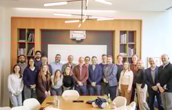
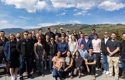
ERM is the world’s largest specialist sustainability consultancy, with over 50 years of experience helping organizations navigate complex environmental, social, and governance challenges. We bring together a global community of experts to deliver meaningful impact for our clients and the planet.
Our Consulting Delivery Hub (CDH) in India is a critical part of ERM’s global consulting model enabling scalable, high-quality delivery across regions and service lines. CDH teams work in close partnership with regional consultants to support global client projects, providing specialist expertise, driving consistency, and enhancing delivery efficiency across our most important programmes.
As part of the Consulting Delivery Hub, you will collaborate with colleagues worldwide, contribute to complex sustainability projects, and play a key role in shaping the future of global consulting delivery.
Why this role matters?
As a GIS Senior Associate, you will support ERM’s global consulting delivery by providing geospatial technical solutions for environmental and sustainability projects worldwide. You will work within the team of geospatial professionals and as GIS Senior Associate your role will be to blend geospatial expertise with environmental consulting, offering opportunities to work on multidisciplinary projects in site investigation and remediation, capital project delivery, due diligence, and environmental planning.
What will you bring?
Good command on fundamentals of Geospatial technology and techniques, geo analytics and integrated spatial data collection, management and visualization skills.
Proficiency in industry standard geospatial software and technologies.
Ability to obtain, process, and interpret geospatial data and integrate spatial and non-spatial data for environmental studies.
Attention to detail and problem-solving skills, using interdisciplinary perspectives on how to use spatial data to solve environmental studies challenges.
Essential qualifications, skills & competencies
Bachelor’s or Master degree in Geoinformatics, Geography, Environmental Sciences, Geology, Environmental Engineering, or a related field.
Minimum 3-4 years of professional experience in Geospatial or environmental consulting. Proficiency in Esri’s ArcGIS Suite of Technologies - ArcGIS Desktop (ArcGIS Pro) and its extension tools, ArcGIS Enterprise, ArcGIS Online, Field Survey and mobile applications such as Survey 123, Field Maps and experience with AutoCAD Map and Civil 3D is a plus.
Knowledge of programming languages such as Python, JavaScript, Oracle, or SQL for automation, custom tool and GIS application development.
Good understanding of geodatabase management, including domains, subtypes, and feature class operations.
Skilled in projections/coordinate systems, geoprocessing tools (joins, merges, topology, dissolves), symbology configuration, labelling, annotation, and definition queries.
Good communication skills and attention to detail, with a focus on professional presentation of maps and visualizations.
Ability to work effectively in team environments and deliver quality projects on time and within budget.
Preferred skills & competencies
Remote Sensing and Digital Image processing.
Advanced geospatial modelling and cloud computing and spatial analysis using GEE.
Knowledge and experience on GeoAI applications, especially ESRI’s pretrained models and the AI model training process for tailored solutions and needs.
Key responsibilities
Collaborate with multidisciplinary teams to ensure Geospatial data and map deliverables meet or exceed client expectations.
Plan, design, implement, and maintain large, complex, multiyear GIS projects.
Organize and manage project data, analysis, and mapping following company protocols and industry best practices.
Design and produce maps in ArcGIS platform for technical reports, including:
Potentiometric maps
Groundwater plume and free-phase design
Geological cross-sections
Land use and land cover maps
Location alternatives and sensitivity maps
Impacted area maps (direct/indirect) - Historical aerial/satellite imagery comparisons
Validate topographic data from subcontractors and transform CAD, Google Earth, and PDF layouts into GIS formats.
Update and maintain GIS databases and datasets. Develop and publish online maps using ArcGIS Online and Enterprise.
Build and deploy field data collection systems using Survey123, Field Maps, and Trimble GPS. Author and edit geoprocessing scripts and tools using Python and ModelBuilder.
Promote continuous improvement through automation and innovation in GIS workflows.
Skills Required
- Bachelor's or Master's in Geoinformatics, Geography, Environmental Sciences, Geology, Environmental Engineering, or related field
- Minimum 3-4 years professional experience in Geospatial or environmental consulting
- Proficiency in Esri ArcGIS Suite (ArcGIS Desktop/Pro, ArcGIS Enterprise, ArcGIS Online)
- Experience building/deploying field data collection systems using Survey123, Field Maps, and Trimble GPS
- Knowledge of programming languages for automation and GIS app development: Python, JavaScript, Oracle, SQL
- Ability to author and edit geoprocessing scripts and tools using Python and ModelBuilder
- Good understanding of geodatabase management (domains, subtypes, feature class operations)
- Skilled in projections/coordinate systems, geoprocessing tools (joins, merges, topology, dissolves), symbology, labeling, annotation, definition queries
- Ability to obtain, process, interpret geospatial data and integrate spatial/non-spatial data for environmental studies
- Good communication skills, attention to detail, and ability to work in team environments to deliver projects on time and within budget
- Experience validating topographic data and transforming CAD, Google Earth, and PDF layouts into GIS formats
- Experience with AutoCAD Map and Civil 3D
- Remote sensing and digital image processing
- Advanced geospatial modelling, cloud computing, and spatial analysis using Google Earth Engine (GEE)
- Knowledge and experience with GeoAI applications, ESRI pretrained models, and AI model training for GIS solutions

What We Do
ERM (Environmental Resources Management) is a global sustainability consultancy that helps organizations navigate environmental, social, and governance (ESG) challenges. ERM provides advisory and technical services across sectors—energy, mining, infrastructure, manufacturing and finance—supporting decarbonization, regulatory compliance, risk management, and sustainability strategy and implementation through technical, engineering and strategic consulting worldwide.


.png)