Arcadis is the world's leading company delivering sustainable design, engineering, and consultancy solutions for natural and built assets.
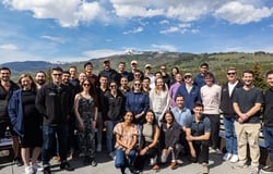
We are more than 34,000 people, in over 30 countries, dedicated to improving quality of life. Everyone has an important role to play. With the power of many curious minds, together we can solve the world’s most complex challenges and deliver more impact together.
Role description:
Arcadis is seeking a GIS Specialist to join our Enviro Socio Permitting team in the Western U.S. The successful candidate will provide Geographic Information Systems (GIS) support for environmental permitting, environmental data management, and data collection/analysis. This role will primarily support linear infrastructure projects in California, with additional opportunities to support energy and mining projects throughout the Western U.S.
The position will require a candidate to work effectively in a collaborative, interdisciplinary team of resource specialists while managing multiple priorities and concurrent projects to meet deadlines. Arcadis offers a flexible working environment and follows a hybrid work structure. A successful candidate can expect to work remotely and from the office, as needed, based on demands of specific tasks and teams. This position will report to a Senior GIS Lead and be part of the larger Enviro Socio Permitting GIS team with opportunities to learn and develop GIS skills.
Role accountabilities:
As a GIS Specialist, you will apply your technical knowledge to provide high quality GIS analysis and deliverables to support planning and permitting for linear utility and mining clients. You will be an important member of the Enviro Socio Permitting team interacting with other GIS professionals, ecologists, cultural resource specialists, planners, engineers, senior technical experts and project/program managers as part of an interdisciplinary team.
The position requires a thorough understanding of GIS Principles and experience with the latest versions of ESRI products. A successful candidate will exhibit the ability to perform highly detailed work on multiple, concurrent tasks, with exceptional quality in the work product. You will be responsible for supporting desktop reviews and environmental permits, maintaining data for projects, and preparing project figures. You will support Arcadis's Digital Initiative by leveraging ArcGIS Online and ArcGIS Pro for data management, field data collection support, analysis and visualization via applications such as ArcGIS Field Maps and Experience Builder.
Qualifications & Experience:
Required qualifications for the role include:
- Bachelor’s degree in geography or environmental science, or similar, with a focus in Geographic Information Systems (GIS).
- Demonstrated experience in ESRI products including ArcGIS Pro, ArcGIS Online, Field Maps and Experience Builder
- Experience with cartography and figure creation
Preferred qualifications for the role include:
- One year of experience applying GIS skills to the environmental science field or an advanced degree in GIS.
- Data management skills for both spatial and non-spatial data, including geodatabases, shapefiles, CAD files, KMZs, GPS, spreadsheets, etc.
- Experience with linear infrastructure projects (e.g., utility projects, pipeline projects, etc.).
Why Arcadis?
We can only achieve our goals when everyone is empowered to be their best. We believe everyone's contribution matters. It’s why we are pioneering a skills-based approach, where you can harness your unique experience and expertise to carve your career path and maximize the impact we can make together.
You’ll do meaningful work, and no matter what role, you’ll be helping to deliver sustainable solutions for a more prosperous planet. Make your mark, on your career, your colleagues, your clients, your life and the world around you.
Together, we can create a lasting legacy.
Join Arcadis. Create a Legacy.
Our Commitment to Equality, Diversity, Inclusion & Belonging
We want you to be able to bring your best self to work every day. Our ambition is to be an employer of choice and provide a great place to work for all our people. We are an equal opportunity employer. We are dedicated to a policy of non-discrimination in employment on any basis including race, creed, color, religion, national origin, sex, age, disability, marital status, sexual orientation, gender identity, citizenship status, disability, veteran status, or any other basis prohibited by law.
Arcadis offers benefits for full time and part time positions. These benefits include medical, dental, and vision, EAP, 401K, STD, LTD, AD&D, life insurance, paid parental leave, reward & recognition program and optional benefits including wellbeing benefits, adoption assistance and tuition reimbursement. We offer nine paid holidays and 15 days PTO that accrue per year. The salary range for this position is $49,680 - $82,800 / year. Actual salaries will vary and are based on several factors, such as experience, education, budget, internal equity, project and location.
Skills Required
- Bachelor's degree in geography, environmental science, or similar with a focus in GIS.
- Demonstrated experience with ESRI products including ArcGIS Pro, ArcGIS Online, Field Maps and Experience Builder.
- Experience with cartography and figure creation.
- One year of experience applying GIS skills to the environmental science field or an advanced degree in GIS.
- Data management skills for spatial and non-spatial data (geodatabases, shapefiles, CAD files, KMZs, GPS, spreadsheets).
- Experience with linear infrastructure projects (e.g., utility or pipeline projects).
What We Do
Arcadis is the world’s leading company delivering sustainable design, engineering, digital and consultancy solutions for natural and built assets. We are more than 36,000 architects, data analysts, designers, engineers, project planners, water management and sustainability experts, all driven by our passion for improving quality of life. We exist to find solutions to today’s most pressing challenges, from the impact of climate change to increasing urbanization and digital transformation – all with the goal of improving quality of life for people around the world. You can see this in the work we do for our clients, the opportunities we create for our people, and in our efforts to enhance the communities in which we live and work. We bring together world-class resources and the latest innovative technologies to help define the cities and experiences of tomorrow. Arcadis. Improving quality of life